26 September, 2011

Cambodia GPS Garmin

Cambodia Garmin GPS Map by GPSTravelMaps.com and geodata by Kaart Data is compatible with ALL Garmin devices.


Cambodia GPS Map can either be sent to your email address in minutes as a digital download or if you purchase the SD card then it will be shipped to your front door. The digital download can be installed in minutes from your PC or Mac to your Garmin device. The Cambodia GPS micro SD card requires no installation except sliding it into your GPS device.

The Cambodia GPS map will give you turn by turn directions to your destination using a POI (point of interest), city point and/or latitude and longitude with the ability to preplan driving destinations before getting into your car.   The easy to follow instructions allow you to download and install the map into Garmin Mapsource desktop software and transfer it to your Garmin GPS in minutes.  Compatible with ALL Garmin GPS units.   Don't pay more than US$10 per day when you already own a Garmin, this is the most comprehensive GPS map available at such an affordable price!


Highway, Major and Local class roads added to the Cambodia GPS Map 


Cambodia GPS Map Update History

v 1.0 

  • Highways 
  • Major  Roads 
  • Local Roads
  • National Parks
  • Rivers
  • City and town points
  • Airport points and runways
  • Lakes
  • Golf Courses
  • Gulf of Thailand
  • Points of Interest


    Mapping Phnom Penh for the Cambodia GPS Map 


    Street level detail in Phnom Penh


    Over 23,000 POIs added to the Cambodia GPS Map


     09/26/2011
    Roads Edited 
    • Phnom Penh
      • road class fixed
      • road added and aligned with the aid of satellites images 


Roads added to the Cambodia GPS map based off of satellite images.


20 September, 2011

Top Beaches Costa Rica

Looking for feedback on what you think are the best beaches in Costa Rica.

Please leave in the comments section below what beaches you think are the best in Costa Rica and why -surfing, swimming, fishing, etc...?

Haiti GPS


The Haiti GPS map will give you turn by turn directions to your destination using a POI (point of interest), city point and/or latitude and longitude with the ability to preplan driving destinations before getting into your car.   The easy to follow instructions allow you to download and install the map into Garmin Mapsource desktop software and transfer it to your Garmin GPS in minutes.   Compatible with ALL Garmin GPS units.   This is the most comprehensive GPS map available at such an affordable price!


Haiti GPS street level detail Port - Au - Prince

Statistics of the Haiti GPS map:

•  13,200+ kilometers of Highways, Major Roads and Residential Streets with turn-by-turn, voice guided directions.
•  Over 4,500 unique points of interest.
•  All rivers, streams, lakes, wetlands, beaches, volcanos, mountain summits, golf courses, ferry's, parks, cemeteries, etc.


Haiti GPS Update History


v 1.8 | October 2011
•  Added POI's throughout Haiti.
•  Improved navigation.
•  Improved lake polygons.
•  Ground truthed map data in September 2011.

v 1.7 | January 2011

•  Added POI's throughout the Port-au-Prince region.
•  Added road names to hundreds of roads.
•  Corrected and improved routing on all Highways and major roads.

v 1.6 | June 2010

•  Split the map into two according to country.
•  Added highway labels.
•  Improved routing in the routable version.


v 1.5 | February 2010

•  Added local streets throughout Samana Peninsula, including Samana, Las Terrenas and Sanchez.
•  Added POIs throughout the Samana Peninsula.
•  Improved routing in map.

v 1.4 | February 2010

•  Added local streets into 
Jarabocoa, Constanza, San Francisco de Macoris, Petit Goave, Punta Cana, Azua, Bani, Vicente Noble, Barahona, San Cristobal, Samana, San Juan de la Maguana, Puerta Plata, Saint-Marc, Gonaives, Cap-Haitien, Monte Cristi, San Pedro de Macoris, and La Romana.
Manabao, 
•  Fixed routing throughout island.

v 1.3 | January 2010

•  Added local streets throughout Haiti.

v 1.2 | January 2010

•  Added over 1,200 additional points of interest into the map.

v 1.1 | January 2010

•  Added local roads into Port-au-Prince, Cap Haitien, Gonaives, Saint Marc, Petionville, Leogane, Jacmel.
•  Improved highways throughout Haiti.
•  Added Rivers and Streams.
•  Added local roads into San Pedro de Macoris, La Romana, San Juan de la Maguana.
•  Improved ocean polygon.

v 1.0 | November 2009

•  Created original map including...
•  Highways throughout Dominican Republic / Haiti.
•  Major Roads throughout Dominican Republic / Haiti.
•  Local roads through Santo Domingo and Santiago.
•  National & City Parks.
•  Large and small lakes.
•  City and town points (over 45,000 points of interest).
•  Railroads.
•  International boundary lines.
•  Caribbean Sea.

Haiti Churches Helping Churches

Churches Helping Churches in Haiti
David Shin September 19th 2011

My name is David Shin and I am one of two people work for an organization called Churches Helping Churches (CHC).  CHC is a global partnership of church communities who seek to rebuild other churches in the wake of a catastrophic natural disaster.  Our efforts are intended to provide spiritual support and development aid to the pastors and their churches who are often the de facto leaders in these affected communities, as a complement to the initial waves of humanitarian aid that pour into a country in the wake of a disaster.  Many countries have relied on networks of local churches to be a primary conduit for the flow of health care, humanitarian aid, and even education.  Rebuilding churches is a strategic means of restoring not only the spiritual health and global fellowship of these affected communities, but also the infrastructure through which aid can flow into communities that so desperately need it.


                CHC has brought a very unique form of relief to men/women who are often at the forefront of physical, emotional, and psychological relief efforts; local pastors.  These men/women worked non-stop to counsel the grieving, help the hurting, and feed the hungry immediately after the earthquake.  CHC provided short retreats for the pastors all throughout Haiti, offering them time to replenish their own bodies, minds, and spirits; many of the pastors did not even have time to grieve their own losses.  These retreats also provided post-traumatic-stress counseling training and specifically, disaster relief counseling training to equip the pastors for the work in their communities.  Over 980 pastors have been to our retreats at 8 different locations throughout Haiti.

                Church reconstruction is another major initiative CHC has been fortunate to be a part of.  Through the funds raised from churches around the world, CHC has been able to donate over 30 immediate transitional structures to churches and help 40 churches to repair structural damages to continue using buildings for relief efforts.  Additionally, CHC is currently in the process of building 20 new church structures.  These structures are advanced steel designs that are earthquake resistant against 8.0 magnitude earthquakes, hurricane resistant (able to withstand winds up to 140 mph), and are able to be constructed by local community members.  More information about this project is detailed on our blog.   

                GPSTravelMaps Haiti GPS map will be an essential tool for us to continue building out the rest of our structures for these churches.  Our local project manager is required to travel to and from many sites as well as suppliers.  If you have ever driven in Haiti before, you understand that it is very difficult to get around unless you have spent much time there.  Even Haitians can get lost in areas where they have never visited as street names are nonexistent and roads may have changed due to the earthquake.  Donations have been the lifeline of our organization as much of our funds go towards our development efforts.  As I am one-half of our salaried staff in the United States, we try to keep overhead minimal to achieve the most out of every donation.  For more information on our work, including photos, videos, and stories, please visit   


Haiti GPS Map updates can be found here - Haiti GPS Map


11 September, 2011

Dominican Republic GPS Map

Dominican Republic GPS Map details can be found here -
           DOMINICAN REPUBLIC GPS MAP 


9/10/2011


Mapping trip for Dominican Republic has begun. Landed in Santo Domingo last night and drove to Barahona. Stopped at a police check point. We thought they wanted a bribe. Nope all they wanted was for us to drive the police captain for about an hour to another town. We enjoyed his company and his snoring. Off to Haiti ...


9/11/2011
Haiti 


9/12/2011
Port au Prince, Haiti to Punta Cana, Dominican Republic


9/13/2011
Dominican Republic
Punta Cana to Las Terrenas

07 September, 2011

Jamaica GPS Map

Do you have a trip planned to Jamaica? Are you the adventurous type that wants to not only drive to your resort but also venture out to see the country of Jamaica? Then we have the perfect companion for you on your next trip to Jamaica - the Jamaica Garmin GPS map by GPTravelMaps.com.


Click the Buy Map Banner below to go to the GPSTravelMaps.com Store -


The Jamaica GPS map will give you turn by turn directions to your destination using a POI (point of interest), city point and/or latitude and longitude with the ability to preplan driving destinations before getting into your car.   The easy to follow instructions allow you to download and install the map into Garmin Mapsource desktop software and transfer it to your Garmin GPS in minutes.   Compatible with ALL Garmin GPS units.   This is the most comprehensive GPS map available at such an affordable price!


Jamaica GPS Map Update History

v 1.2 | October 2011
•  Added POI's throughout Jamaica.
•  Added local roads.
•  Improved search for POI's.
v 1.1 | September 2011
•  Added POI's throughout Jamaica.
•  Improved navigation.
v 1.0 | September 2011
•  Created original map including….
•  Highways throughout Jamaica.
•  Major & Local Roads throughout Jamaica.
•  Rivers and Streams.
•  Golf Courses.
•  City and town points.
•  Various POI's.
•  Airport points and runways.
•  Caribbean Sea.


Other Caribbean GPS Maps Available 

06 September, 2011

Climb Kilimanjaro


If you are thinking about or will be climbing Mount Kilimanjaro then add these three items to your tools to conquer Mount Kilimanjaro!


Mount Kilimanjaro, Tanzania GPS Map Download for Garmin Devices


3. Go to this site - All about climbing Kilimanjaro - Tanzania Odyssey Specialist for Travel to Tanzania.


More about the Mount Kilimanjaro GPS map ...

"Thanks for your map, Aaron, which I’ve been studying over the weekend and enjoyed very much. The contoured base map is beautiful and I like the way I can superimpose my own tracks on top – really great. I’m impressed with the map, and will be mentioning it in the next edition of the book, as well as online."


—Henry from Tanzania (June, 2009)


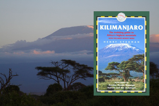
Henry Stedman is the author of Kilimanjaro: A Trekking Guide to Africa's Highest Mountain and the creator of ClimbMountKilimanjaro.com.  Coming from an expert Kilimanjaro guide, we think that kind of praise for our map says a lot!
The Mount Kilimanjaro GPS topographic map of Kilimanjaro available for your Garmin GPS device offers you greatly improved detail for your climb.  The contours are spaced 20 meters apart for the entire mountain, allowing you to view the terrain while making your way to the summit.
In addition to the contours of the mountain, other geographic features are included in the map.  Park boundaries for Kilimanjaro and Urusha National Parks, hiking routes to the summit, national and local roads, rivers and streams, lakes and wetlands, airports, campsites, and many more.  This map is continually being upgraded to provide the best GPS map for the area.

Mt Kilimanjaro GPS Map Update History

v 1.8 | July 2009

  • Added auto-routing to a new Routable/Navigable version of the map.
  • Improved road and trail geometry throughout the map.
  • Added & Improved POI's around the mountain and in Moshi.

v 1.7 | May 2009

  • Added additional POI's on mountains.
  • Added Meru peak trails.

v 1.6 | September 2008

  • Added additional local streets in Moshi.
  • Added POI's on mountain.
  • Updated railroads.
  • Updated lakes.


v 1.5 | January 2008

  • Updated highways.
  • Updated streets.
  • Updated lakes.
  • Updated POIs.
  • Updated railroads.
  • Updated rivers.

v 1.4 | September 2007

v 1.3 | May 2007

  • Added Moshi POIs (schools, restuarants, civil buildings, stores, hotels, etc.)
  • Adjusted Moshi urban area.
  • Adjusted Moshi airport boundary.
  • Added Moshi golf course polygon.
  • Added Moshi cemetary polygon.

v 1.2 | March 2007

  • Added Moshi local roads w/ street names.
  • Improved general accuracy.

v 1.1 | February 2007

  • Updated international border.
  • Added provincial border.
  • Updated lakes.
  • Added Wetlands and swamps.
  • Added additional local roads.
  • Added additional points of interest.
  • Added glacier.
  • Added rivers.
  • Added streams.
  • Added railroads.
  • Added urban area around Moshi.
  • Updated intermediate contours.
  • Improved route accuracy.

v 1.0 | January 2007

  • Added International border between Tanzania and Kenya.
  • Added more roads to surrounding area.
  • Changed road details and levels.
  • Added some lakes to map.

v 0.9 beta | December 2006

  • Added park boundaries.
  • Added routes to summit.
  • Added roads around mountain.
  • Added points of interest around mountain.
  • Added campsites and other locations on mountain.
  • Added airports.
  • Added local towns.
  • Changed contour interval from 10m to 20m to decrease file size.
  • Changed map from transparent to standard GPS map.

v 0.8 beta | August 2006

  • Created original transparent contour map without other details at 10m intervals.