28 March, 2014

5 Reasons to Visit Guatemala This Year (5 of 5)

#5 - Beaches

Whether you want white sandy beaches or black, Guatemala has what you're looking for. On the Pacific side, most of Guatemala's beautiful beaches aren't surrounded by high-rise luxury resorts and crowded with tourists; instead you'll find cozy villages, great weather, and peace and quiet. Swimming conditions can be tricky though, so inquire locally about the right time to swim. While you're at it, you can find friendly locals to take you fishing and surfing. If you prefer larger crowds, you can visit the more touristy spots on Guatemala's narrow Caribbean strip. Either way, we're sure you'll have a great time on Guatemala's beaches.

Monterrico, Guatemala's most popular Pacific beach.

Navigating Central America can be tricky, let us help you. Before you go, get your GPS map here.

Our Guatemala map features:


Screen capture from our Guatemala map.

  • Over 20,000 kilometers of highways, major roads and residential streets, with turn-by-turn voice guided directions.
  • Over 30,000 unique points of interest (e.g., shops, hotels, restaurants, hospitals, parks, airports).
  • Fully detailed with all rivers, streams, lakes, wetlands, beaches, volcanoes, mountain summits, golf courses, parks, airports, cemeteries, etc. are included in the map!
To see more great content, follow us on FacebookTwitterGoogle+, and LinkedIn.

This is the last post in our series of Reasons to Visit Guatemala This Year. Check back next week for new posts!

27 March, 2014

5 Reasons to Visit Guatemala This Year (4 of 5)

#4 - Birds


#Guatemala is a bird lover's paradise with seven distinct biomes and over 720 bird species, of which approximately 10% are endemic. #Birding in Guatemala is made easy thanks to six biosphere reserves and 21 national parks. Track down the Resplendent Quetzal, White Hawk, Pale Billed Woodpecker, Rufous Sabrewing (all pictured below), and as many more as you can find. #Birdwatching tours are available for casual travelers as well as cruise ship passengers from @birdinguatemala through the link below.

Pictures from www.birdwatchinguatemala.com

Navigating Central America can be tricky, let us help you. Before you go, get your GPS map here.

Our Guatemala map features:


Screen capture from our Guatemala map.

  • Over 20,000 kilometers of highways, major roads and residential streets, with turn-by-turn voice guided directions.
  • Over 30,000 unique points of interest (e.g., shops, hotels, restaurants, hospitals, parks, airports).
  • Fully detailed with all rivers, streams, lakes, wetlands, beaches, volcanoes, mountain summits, golf courses, parks, airports, cemeteries, etc. are included in the map!
To see more great content, follow us on FacebookTwitterGoogle+, and LinkedIn.

Check back each day this week for more Reasons to Visit Guatemala This Year!

26 March, 2014

5 Reasons to Visit Guatemala This Year (3 of 5)

#3 - Chocolate

Chocolate and Truffles
from ChocoMuseo Antigua
#Chocolate was the "food of the gods" according to the #Mayans, and we'd have to agree. It was so important to them, they inscribed it's harvesting and use onto many of their artifacts. The Mayans drank and ate chocolate for it's healthful and aphrodisiacal qualities, and modern studies have verified many of the healthful benefits of chocolate. On top of all this, people have been refining the chocolate making process here for thousands of years.

In modern times, we can travel to #Guatemala and visit ChocoMuseo Antigua. Here you can attend a workshop that will guide you through the process of making your own chocolates or truffles in about 2 hours for only $24 a person. You can also do a full day plantation tour, which includes harvesting your own cacao, ecology instruction, and learning to make hot chocolate like the Mayans.

Find out more about ChocoMuseo Antigua here. Navigating Central America can be tricky, let us help you. Before you go, get your GPS map here.

Our Guatemala map features:


Screen capture from our Guatemala map.

  • Over 20,000 kilometers of highways, major roads and residential streets, with turn-by-turn voice guided directions.
  • Over 30,000 unique points of interest (e.g., shops, hotels, restaurants, hospitals, parks, airports).
  • Fully detailed with all rivers, streams, lakes, wetlands, beaches, volcanoes, mountain summits, golf courses, parks, airports, cemeteries, etc. are included in the map!
To see more great content, follow us on FacebookTwitterGoogle+, and LinkedIn.

Check back each day this week for more Reasons to Visit Guatemala This Year!

25 March, 2014

5 Reasons to Visit Guatemala This Year (2 of 5)


#2 - Tikal


There are over 100 known Mayan sites in #Guatemala, and a serious lover of Mayan culture will try to visit them all. But for everyone else, if you're only going to see one Mayan city, it has to be #Tikal. Tikal National Park has more than 3,000 structures in about six square miles. These structures include temples, ball courts, terraces, palaces, plazas, and steam baths, among others. Tikal was the largest city and capitol (home to an estimated 100,000 people) of the Mayan world from about 200 A.D until 900 A.D., when it was mysteriously abandoned. 

File:Tikal mayan ruins 2009.jpg
By chensiyuan (chensiyuan) via Wikimedia Commons

#Naturalists are also drawn to Tikal for the amazing flora and fauna. Monkeys, parrots, macaw, deer, peccary, coatimundi, ocelots, and many other forms of animal life, including an occasional jaguar, can be seen in the jungles surrounding Tikal. With it's combination of natural beauty and archaeological marvels, it's no wonder that this @UNESCO Heritage site tops many people's bucket lists.

Let us help you navigate Guatemala. Before you go, get your GPS map here.

Our Guatemala map features:


    A screen capture from our Guatemala map.

  • Over 20,000 kilometers of highways, major roads and residential streets, with turn-by-turn voice guided directions.
  • Over 30,000 unique points of interest (e.g., shops, hotels, restaurants, hospitals, parks, airports).
  • Fully detailed with all rivers, streams, lakes, wetlands, beaches, volcanos, mountain summits, golf courses, parks, airports, cemeteries, etc. are included in the map!
To see more great content, follow us on FacebookTwitterGoogle+, and LinkedIn.

Check back each day this week for more Reasons to Visit Guatemala This Year!

24 March, 2014

5 Reasons to Visit Guatemala This Year (1 of 5)

#1 - Semana Santa (Holy Week)


#HolyWeek is a wonderful time to visit #Guatemala. It is a time of great religious and cultural expression and therefore the perfect time to see the people of Guatemala in action. Beginning Ash Wednesday, processions leave from multiple churches (a partial list is available here) and follow colorful “alfombras” through the city, carrying their Christ figure.

A procession following beautiful Alfombras.
Image from: http://www.adesca.org.gt/gestores/blog/?p=3833

Experience the Easter season in a unique and uplifting way this year in Guatemala!

Thousands of visitors come to Guatemala for Semana Santa, so you’ll want to get your travel plans in place now. Before you go, get your GPS map here.

Our Guatemala map features:


    A screen capture from our Guatemala map.

  • Over 20,000 kilometers of highways, major roads and residential streets, with turn-by-turn voice guided directions.
  • Over 30,000 unique points of interest (e.g., shops, hotels, restaurants, hospitals, parks, airports).
  • Fully detailed with all rivers, streams, lakes, wetlands, beaches, volcanos, mountain summits, golf courses, parks, airports, cemeteries, etc. are included in the map!
To see more great content, follow us on Facebook, Twitter, Google+, and LinkedIn.

Check back each day this week for more Reasons to Visit Guatemala This Year!

23 March, 2014

My Travel Bucket List

Have you caught spring fever yet? I am just aching for a change of scene and variety, and that's when I start thinking about all of the places on my "must see before I die" bucket list. Here are a few of the destinations on my list. What places are on yours?


#1 - Hiking Dominica
I admit it was an episode of "Man, Woman, Wild" that first introduced me to the breathtaking beauty of Dominica, but I have learned more about it in my work with GPSTravelMaps.com. When I learned about the Waitukubuli National Trail from our Dominica GPS map I knew I had to get there someday. With 114 miles of trail there is something for everyone as far as scenery and hiking difficulty. Waterfalls, ruins, jungle, and more await discovery. This tropical paradise includes plenty of locations for beach relaxation as well as outdoor adventure and wilderness solitude. It's the perfect vacation in my book. Our GPS map includes the Waitukubuli National Trail, thousands of POI's, and road coverage for easy turn by turn navigation so don't start your travels without first purchasing the Dominica Garmin GPS map from GPSTravelMaps.com .


Hiking in Dominica


#2 - Machu Picchu 
Who doesn't want to visit this place, really? I have since I was a kid, but I learned a few years ago through our Peru GPS map how I wanted to visit it. There are multiple trails leading to the famous ruins and each passes through its own unique vistas and places of interest. I have one of the "alternate trails" in mind for my visit. Read up on these trails here and then buy our Peru map to help you navigate your trail of choice.  


Machu Picchu

#3 - Roatan, Honduras
I spent a week in Honduras a few years ago, but never made it to Roatan.  We had an amazing time along the north coast zip-lining over hot springs which we later soaked in, and snorkeling and hanging with the Garifuna people in Cayos Cochinos , but all that only upped my desire to get to Roatan one day. Scuba diving and snorkeling at a coral reef to rival Australia, shopping, white sandy beaches, turqoise waters, and luxury at more than half the cost of most other tropical vacations - what's not to like? If you make it to Roatan there is so much on the mainland of Honduras you won't want to miss either like the Copan ruins, the Pulhapanzak waterfall,  and Punta Sal.  With our Central America map bundle which includes a map of all of Honduras (even Roatan) you can be assured you won't have to miss out on any of it. For the price of one map you get maps for several other Central American countries too so why not explore them all?


Roatan from the air

Honduras Paradise

#4 - Surfing in Costa Rica
I love water and I'm a decent swimmer so surfing has been on the to-do list for awhile, but even when I've made advance arrangements and traveled across several states to get to the coast, it just doesn't work out for me to try it. Which of course just increases the allure of the sport for me. I've wanted to visit Costa Rica ever since my high school's environmental science class went I did not, so when I learned that not only were rainforest exploration, volcanos, tree frogs, and huge iguanas all famous in Costa Rica but also surfing?! Well, it immediately became a bucket list item. If any of that sounds like the vacation you are looking for start planning your trip to Costa Rica.  And I guarantee you won't want to leave without our Costa Rica GPS map.  It is detailed and up to date with all the data you will need to get to where you want to go so you can do what you want to do.


La Fortuna Waterfall, Costa Rica

#5 - Guna Yala, (formerly known as San Blas) Panama
Guna Yala is a 120 mile area stretching along the eastern coast of Panama and includes remote islands off the coast as well. Not only are there pristine white beaches, coral reefs, and everything else to make it a tropical paradise, but this is also the one and only place you can experience the colorful culture of the indigenous Guna people. Once I've had my fill of snorkeling on my own private island and exploring the thatched roof shops of the Guna, I'll would definitely take in the rest of the Panama destinations that are on my bucket list like the Panama canal, the Pearl Islands, and the Baru Volcano. Our Panama Garmin GPS map which can be purchased in our Central America map bundles will get me and you to all of these locations and more.  Send me an email at support@gpstravelmaps.com and I'll get you a coupon code that will allow you to purchase the bundle for the price of just 1 map! You'll get Panama plus Nicaragua and Costa Rica all for $49.95


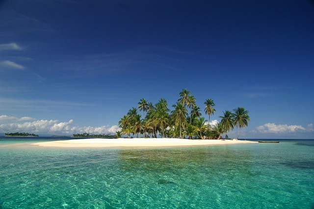
One San Blas Island in the Guna Yala region

I'm not sure if my spring fever is worse or better after pondering all of these amazing destinations, but regardless I'll keep day dreaming anyway. Let me know what bucket list destinations we have in common below in the comments. Did you add any from my list to yours? And PLEASE share all the other locations I need to add to my list so I can day dream about those too.

-Nicole.

21 March, 2014

Haiti GPS Map updated - Ideal for Humanitarian use

GPSTravelMaps.com has been updating and offering a comprehensive GPS map for Garmin devices of Haiti since 2009.  In 2010 a magnitude 7.0 earthquake occurred near the town of Leogane, just outside Port-Au-Prince.  Immediately thereafter relief efforts began in Haiti, many of which flowed through the Dominican Republic, and provided much needed medical and food services to the Haitian citizens affected by this natural disaster.

Haiti is a country unfamiliar by most as it is not a typical 'tourist' destination apart from Royal Caribbean Cruise Lines stop in Labadee in the north of the country, an area not affected by the earthquake.  Many organizations including military, international and local NGOs and individuals were seeking accurate GPS navigation to help them navigate the Haitian roads.  These roads, however, we severely damaged and blocked with earthquake rubble.  GPSTravelMaps sourced information from various locations including social media to learn of the conditions on the ground and update the map accordingly.  At this time, we provided the GPS map at no charge to relief workers so that they could do their work without the additional cost to their organizations.

We have continued to update the Haiti GPS Map with our most current update in March 2014.


Haiti GPS Map Update History
 
v 2.2 | March 2014
Added 80 km of new roads.
Added 7 km of oneways.
Added names to 30 km of roads.
Improved navigation in Ile a Vache, The Citadelle LaferriËre, Cap Hatien, Camp Perrin, Kenscoff, Port-a Piment, Debaucher, Roche-a Bateau, Potr Salut, Torbeck, Les Cayes, Jacmel, Mole Saint Nicolas, Petionville, Jereme, Bonbon, Abricots, Dame Marie, Anse-d Hainault, Les Irois, Tiburon, Marigot, Les Anglais.

v 2.1 | July 2013
Added over 269 km of new roads.
Added 104 new POIs.
Improved navigation.

v 2.0 | January 2013
Added over 50 km of new roads.
Added Red Cross POI.
Added road names to Hinche.
Improved navigation in Hinche and Gonaives.

v 1.9 | April 2012
Added POI's throughout Port-au-Prince and Petionville.
Added oneway street in Port-au-Prince and Petionville.
Improved navigation and search features.

17 March, 2014

5 Amazing Reasons to Visit Belize this Spring

Belize is a culturally amazing and naturally beautiful country. It is doubly distinguished as the only Central American country to have English as the official language and to be without a Pacific coastline. The nation further prides itself on being Mother Nature's Best Kept Secret. Although natural beauty alone is enough to attract most of us, here are a 5 amazing things about Belize that will get you to start making travel plans #iwannago
  1. Food Festivals
    The first weekend in May features the annual Cashew Festival held at Crooked Tree Wildlife Sanctuary. Enjoy roasted cashews, cashew wine, jam, cake, and other delights.
    Celebration at the San Pedro Lobster Festival.
    The Toledo Cacao Festival allows you to sample some of the highest quality cacao beans and chocolate in the world. This three day event in late May will show you why Belizean chocolate is gaining worldwide recognition.
    Three lobster festivals mark the transition from spring to summer and combine a variety of lobster dishes with music and dancing. The San Pedro Lobster Festival kicks off the fun, followed by Festivals in Placencia and Caye Caulker.                                                            
  2. Kayaking  
    A scene from the 2007 Abergris Caye
    Belize Lagoon Reef Eco-Challenge
    Belize boasts fantastic sea kayaking opportunities due to the protection of a barrier reef. Atoll lagoons are also popular and safe kayaking locations. Coastal exploring will reveal the adventure of cave kayaking among the many coastal limestone formations. 
    For the more competitive, Belize hosts multiple Eco-Challenge kayak races to promote awareness and protection of it's natural beauty. Two of the most popular are the San Pedro Lagoon-Reef Eco-Challenge in early April, and the Ambergris Caye Belize Lagoon Reef Eco-Challenge in June.                                    
  3. Diving
    Dive the Great Blue Hole.
    Join the likes of Jacques Cousteau by diving Belize's famous Great Blue Hole. This submarine sinkhole was ranked #1 on the Discovery Channel's “10 Most Amazing Places on Earth” in 2012. The Great Blue Hole is also a UNESCO World Heritage Site.
    The entire spring season is great for diving with Whale Sharks near Gladden Spit. This area is a spawning site for a wide variety of fish species, drawing in the Whale Sharks, and curious divers. Diving must be done in an organized group setting for safety, but doesn't limit the adventure.                                                                                                           
  4. Caving
    One of thousands of available caves.
    Belize's amazing Karst topography, made possible by it's extensive limestone deposits, will amaze even the most Speluncaphobic. The natural formations provide amazing scenes of stalactite and stalagmite formations and underground waterfalls. Literally thousands of caves dot the landscape providing enjoyment for all levels of cave enthusiasts. Actun Tunichil Muknal Cave (Cave of the Crystal Sepulchre) is ranked #1 on National Geographic's “Top 10 Sacred Caves” and has been featured on Ghost Hunter's International due to it's Mayan archaeological remains, including ceramics, skeletons, and stoneware.                                                                                                                                   
  5. History
    Belize has some amazing Mayan ruins, two of the most fascinating being Xunantunich and
    Xunantunich
    Caracol. Xunantunich, or the “Stone Woman,” was an important ceremonial center, while Caracol was one of the most important political centers of the Mayan Classic Period. In it's heydey, it was larger and more populous than present-day Belize City.
    Also, visit Lamanai, a partially jungle-covered ruin, currently being excavated by archaeologists. This site was still occupied by Mayans when the Spanish arrived, and consequently is one of only a few sites to retain it's original name.
    You may also visit the annual Archaeology Symposium, July 1st through 4th. For about $10 a day, you can attend symposiums on either of this years themes: Ancient Maya Domestic Economy: Subsistence, Commerce, and Industry, or Archaeology in Belize: Research, Investigations, Results.
Before You Go:
Don't forget to pick up your map of Belize before you go: http://www.gpstravelmaps.com/gps-maps/central-america/belize.php. This excellent map features hundreds of kilometers of roads, waterways, national parks, Mayan ruins, and other points of interest. Travel like a local with your GPS!
Belize Map

Enjoy this article and/or @gpstravelmaps? Like us on Facebook to see more: https://www.facebook.com/pages/ GPSTravelMapscom/59184244777.
We'd also like to see you on Twitter: https://twitter.com/gpstravelmaps.

And you can connect with us on Google Plus (https://plus.google.com/+Gpstravelmaps/posts), see some of our pictures on Pinterest (http://www.pinterest.com/gpstravelmaps/), and view some of our footage on YouTube (https://www.youtube.com/user/GPSTravelMaps).

12 March, 2014

GPS Map of Anguilla, explore the Caribbean!

GPSTravelMaps.com has updated the most comprehensive map of Anguilla with even more hotels and restaurants.  Anguilla, small in size, is quickly becoming a favorite destination for those travelers looking to find pristine beaches and waters while avoiding the crowds of destinations such as Punta Cana and Jamaica.  The Anguilla Tourist Board writes that Anguilla is "embraced by unrivaled white beaches and breathtaking turquoise seas, Anguilla is casual and easy, a unique blend of high style and low-key elegance, and the best of the good life set to a slow and casual island tempo."

Now you can navigate with ease and confidence throughout Anguilla with your Garmin.

Click to Buy Map


Below are various images of the Anguila GPS Map in Garmin Basecamp and a Garmin Nuvi.

Anguilla, GPS, Garmin, Nuvi, Caribbean
Accurate road navigation in Anguilla

Hotel, Restaurant, Anguilla, Caribbean, Island, Map
Comprehensive Points of Interest

Detailed Points of Interest

Clear navigation throughout Anguilla

Road names included (where available)

Places you want to go to in Anguilla

GPS guidance with confidence

Complete island coverage in Anguilla

Restaurants and Cafes in Anguilla

Roan names and accurate streets

Resort and Hotel Map of Anguilla


A warm and welcoming island destination tucked away in the  northern Caribbean.  Embraced by unrivaled white beaches and breathtaking turquoise seas, Anguilla is casual and easy, a unique blend of high style and low-key elegance, and the best of the good life set to a slow and casual island tempo.  Anguilla is an experience that captivates our visitors and creates friendships and memories that last a lifetime. - See more at: http://ivisitanguilla.com/#sthash.p5NBJIxv.dpuf

05 March, 2014

Travel to Bermuda and explore it with your own GPS!

Bermuda, we know about the shorts, but did you know there is an accurate GPS map for the islands that allows you to explore while on your vacation?  The Bermuda map is compatible with all Garmin GPS units, particularly the Nuvi models although if you are on a scooter an etrex may be a better option.

With this map, you can easily navigation to all the best beaches including Horseshoe Bay, Warwick Long Bay, Chaplin Bay, Sea Glass Beach and Elbow Beach.  You can also navigate to the Bermuda Aquarium, Bermuda Maritime Museum, Masterworks Museum of Art, National Museum of Bermuda and the Bermuda Underwater Exploration Institute

http://store.gpstravelmaps.com/Bermuda-GPS-Map-p/bermuda.htm?click=1475

You can see more images of the Bermuda GPS map below to learn more about the map details.

GPS Map in Garmin Basecamp software

Bermuda map in Garmin Nuvi
GPS Map in Garmin Basecamp software

Bermuda map in Garmin Nuvi
GPS Map in Garmin Basecamp software

Bermuda map in Garmin Nuvi
GPS Map in Garmin Basecamp software
Bermuda map in Garmin Nuvi

Wat Chalong Temple Driving Directions Map GPS

Wow! Just stunning. If you're planning to travel to Phuket, Thailand, you have to see the Chalong Temple (Wat Chalong).

Our Thailand GPS Navigation map will give you turn by turn driving directions to the Chalong Temple, with voice and map guidance. Our maps will work on any Garmin or iPhone. The Garmin maps are available in the GPS Travel Maps store and our iPhone Thailand GPS Navigation map is available in iTunes. The maps have one way streets marked, street names, points of interest, cities and much more.


There are 2 options for Garmin owners: 1) purchase a memory card to insert into your Garmin or 2) download the map and follow these instructions: http://www.gpstravelmaps.com/instructions.php

You will not need to use your data plan to use our navigation on your iPhone. The GPS Travel Maps Thailand GPS map fits on your phone so you will not need to download anything while in Thailand.


Other available GPS Maps from GPSTravelMaps.com - 

Africa
Egypt
Mt. Kilimanjaro
Madagascar
Morocco
Asia
Cambodia
Hong Kong
Laos
Malaysia
Myanmar
Sri Lanka
Thailand
Vietnam
Oceania
Fiji
Guam
New Zealand
Caribbean - South
Anguilla - Try Free!
Antigua & Barbuda
Aruba
Barbados
Bonaire
Curacao
Dominica
Grenada
Guadeloupe
Martinique
Montserrat
St. Kitts & Nevis
St. Lucia
St. Martin
St. Vincent & Grenadines
Trinidad & Tobago
Virgin Islands
Caribbean - North
Cayman Islands
Cuba
Dominican Republic
Haiti
Jamaica
Turks & Caicos
Central America
Belize
Costa Rica
El Salvador
Guatemala
Honduras
Mexico
Nicaragua
Panama
Middle East
Qatar
United Arab Emirates
Yemen
South America
Ecuador
Fortaleza, Brazil
Peru
Indian Ocean
Madagascar
Maldives
Seychelles
Sri Lanka
Europe
Croatia
Mapsets / Bundles
Caribbean Mapset
Caribbean North
Caribbean South
Central America Mapset
Central America North
Central America South
Southeast Asia